Powered By Blogger

Wednesday, 29 June 2011

Derby and the West Kimberley


Geicke Gorge
Having left Turkey Creek we travelled down the Northern Highway and stopped for lunch at Halls Creek. Intended to stay here but decided differently when we saw the park. Instead we did some shopping, got fuel and continued on. Finally stopped at a rest area called Mary Pool on the Mary River. Fascinating place with at least 60 vans and tents there.The free rest areas in WA are terrific

Sandstone Cliffs on Geikie Gorge
Continued on the next day to Fitzroy Crossing and stayed in a nice park called Fitzroy Crossing Lodge. In the afternoon we took a boat cruise on the Geikie Gorge. Plenty of fresh water crocs on the banks and birds in the trees. The crocs were so tired from sunbaking all day they could hardly move!


Serene Waters of Geikie Gorge

Geikie Gorge was created when the Fitzroy River eroded a deep, narrow passage into the limestone. The water is 30 meters deep at this time of year. The multi-colored walls and cliffs are what is left over from ancient barrier reefs. These barrier reefs existed during the Devonian period millions of years ago, and layers of fossils are visible in the limestone. During the wet season the Fitzroy River floods, and water covers the entire park. The flood waters have been up to 16 metres high and have bleached the bottom layer of the Gorge's walls a bright white. The hut where we bought our ticket was under water (over the 5 metre roof) in the March flood this year!


Geikie Gorge - Magnificent Sight at Sunset
Geikie Gorge is an important Aboriginal cultural area and is known by the Bunaba people as Darngku. Although named after Sir Archibald Geikie in 1883,  I guess it won't be long before it has an aboriginal name. The Bunaba people are the traditional owners but the park is administered by the WA Dept of Env & Consv (DEC)

Entrance to Tunnel Creek
Stayed at the Kimberley Entrance Park in Derby and drove the next day into the Tunnel Creek and Windjana National Parks. This was a drive of about 380km round trip which we did in the one day. Tunnel Creek National Park is WA's oldest cave system and part of the same ancient Devonian reef system as Windjana Gorge. 


Diane Inside Tunnel Creek Cave
The cave has been carved by the waters of Tunnel Creek flowing beneath the Napier Range.You can walk 750 metres into the tunnel, wading waist-deep through freshwater pools.


Tunnel Creek Cave


Wading Through the Cave Water


The cave features many beautiful formations, including stalactites and stalagmites, and is also home to a variety of bats, olive pythons and freshwater crocodiles - so we were told but we didn't see any animals! The photos don't show it but it was very dark in most parts of the cave and we had flashlights and a headlight  to see our way through. The water was cool but not too cold and at the end we waded through waist deep water.


The Exit of Tunnel Creek from the Cave
It was very pleasant to see the exit of the creek - peaceful and serene. At the entry, the walls of the Napier Range are towering above you and you have to climb over and squeeze between big boulders to get into the cave. Walking the creek was quite an experience - it took us about an hour and a half in total and the wearing of old sneakers was essential as we were walking across many rocks on the creek bottom.
Apparently Tunnel Creek National Park, is famous as it was used as a hideout late in the 1800's by a rebel Aboriginal leader known as Jandamarra. He was killed outside its entrance in 1897.

Windjana Gorge (Complete with Freshwater Croc)

We did not realize how magnificent Windjana Gorge is until we got there. Although much smaller, it rivals the gorge at Katherine for beauty. It's also one of the best places to see freshwater crocs in the wild. We saw about 12 in the short time we were there. They were just lazing on the river banks oblivious to the tourists. Windjana Gorge National Park is part of a 375 million-year-old Devonian reef system. Carved out by the Lennard River, the gorge is over three kilometres long with 300 metre-high walls.


Freshwater Croc up Close
 This crocodile was a reasonable size for freshies (about 3 metres long). This one, along with all the others was very quiet, just lazing in the sun and we were able to get quite close - always on the alert, though!


Windjana Gorge in June

Beautiful Windjana Gorge

 At the base of the gorge, there are deep freshwater pools surrounded by native fig, cadjeput and liechardt trees which attract flocks of  corellas, fruit bats and of course, fresh water crocodiles. The area is of great cultural importance to the local Bunuba people who once lived there.


The Prison Boab Tree at Derby
This massive ancient Boab Tree is believed to be around 1,500 years old which makes it the oldest living thing in Australia. It sits on the outskirts of  Derby in the West Kimberley region. The tree is an incredible 14 metres in circumference. With its hollow centre and hole cut into its side for a door, this Boab Tree was once used as a prison by early police patrols in the 1880's as a staging point for prisoners being walked to Derby. Another prison boab tree of similar age and size is located near Wyndham.


World's Longest Cattle Trough
Near the Prison Boab Tree is this cattle trough. Not just any cattle trough but the longest one in the world! It is still in use, is 120m long and can water up to 500 bullocks at the same time. Pretty impressive eh?  It has a constant feed from a nearby windmill operated bore pump.

Finally we left the Kimberleys and headed for Broome and a restful few days by the sea.

Sunday, 26 June 2011

Purnululu National Park (Bungle Bungles)

Diane on the Echidna Chasm Walk
After leaving Parry's Creek we travelled down the Northern Highway to Turkey Creek (now called Warmun). This is a busy place centred around the roadhouse where the caravan park is located. It's an important rest and fuel stop for traffic on the major road between Broome and Kununurra. We left our van here for two days on our trip into The National Park. The ranger station is 107km from Turkey Creek (54km on bitumen and 53km on dirt. The dirt part was something else - 34 water crossings and about 2 1/2 hours to negotiate


Majestic Echidna Chasm
Echidna Chasma is one of the main attractions in the Purnululu Park. It has a moderate walk for about 45 minutes return through a short stretch of undergrowth and into the chasm. This is a spectacular long narrow chasm (not unlike Standley Chasm near Alice Springs but I think this one is longer). The ridges are up to 200m high and yield striking red and golden colour variations from the sun. We were fortunate to be there around midday to see the sun enter from directly above. Note the size of the people in the photo compared with the chasm walls!


Diane is dwarfed by the Size of the Chasm

The walk is up a creek bed and the walls of the chasm slowly close in on each side. It finally gets to the point where the crevice in which you are walking is only a metre wide and a hundred metres high. The light reflects off the orange domes above you and creates an eerie fluorescent glow on the creek bed below. It is simply stunning. It was created by millions of wet season rains and is adorned with tall Livistona palms.


The Magnificent Rock Formations of the Bungle Bungles

The name Bungle Bungles only came into being in 1930. They were named after the old Bungle Bungle Station but the origin of the name is not known although there are a few theories. We are told that this area has been part of Aboriginal Life for 20,000 years, but we didn't see many on our visit. As a result of it's botanical importance and significance, the WA government established the Purnululu National Park in 1987. In 2003 the 240,000 hectare park and 80,000 hectare reserve were declared a World Heritage Area.


View North From Osmand Lookout
In the north of the park and just near Echidna Gorge is a lookout from where you can see the Osmand Ranges. In the foreground you can see the sweep of Red Rock Creek as it drains into Osmand Creek. Truly a fantastic view.

The Domes were formed Millions of Years Ago

Walking in the Park is generally easy. The paths are well marked with plenty of information on grades, distances and amenities. The climate was ideal for walking - not too hot or humid. The park is closed during the wet season (Nov to March) as the place is covered in water.


The Natural Landforms have a Mystical Quality
The beehive like domes are known as karst formations and are regarded as the most exceptional examples of sandstone in the world. They were shaped by the right mix of dissolution, weathering and erosion. Such is their appeal they attract visitors from all over the world, despite the relative remoteness and difficult access.


Our Camp at Walardi Campsite
There are two campsites in the national Park - Kurrajong (northern) and Walardi (southern). Both have their own caretakers and well looked after. We stayed at Walardi for 2 nights and the experience brought us back to our youth with basic tent camping. The caretakers kept the toilets in good shape and provided wood for the fireplaces. They didn't allow anyone to burn wood from the bush. We were pretty well set up with stove, lights, fridge and good bedding. Almost as comfortable as the van!

Bungle Bungle Range with Fabulous Wildflowers in the Foreground
There are several bird, reptile, mammal and frog species in the park but unfortunately we didn't see many of these. We did see a plains turkey (Australian Bustard) a few honey eaters, finches, swallows and of course Kookaburras.
Vegetation in the Kimberleys is typical tropical savannah. Tree species include bloodwoods and snappy gums and numerous species of spinifex  cover the understorey.


Blue Winged Kookuburra on our Picnic Table
We spotted a few Blue Winged Kookaburras near our camp. They were very tame as they came right up to us to be fed. This fella had a feast on bread and toast and would take food from the hand. These may not be rare but we hadn't seen any before.


Entry to the Unnamed Gorge
One of the gorges in the south of the park is unnamed. Amazing as it is such a great spot and an easy walk to get to it. We were told by the ranger that it had special meaning to the aborigines as they used it to herd wild life to catch for their food. Not sure how true that is but sometimes I think they make stories up for the tourists.

Cathedral Gorge

Cathedral Gorge is a vast amphitheatre cut out of the sandstone rock mountain. The walk into the gorge is through striped sandstone beehives, creekbeds, looming cliffs and evidence of waterfalls that would cascade down the rock faces in the wet season. The gorge amphitheatre must be 150 m across with a permanenent pond in the middle.Everyone we spoke to were in awe of the place.

Piccaninny Creek

Piccaninny Creek is a major waterway in the park. In the dry season it's as you can see in the photo - dry as a bone.However, in the wet it becomes a rushing torrent metres deep. The creek bed consists of soft rock which has been worn away in a curved fashion. The path follows the creek bed and it's easier to walk on than the normal creek pebbles!


Wild Flowers in the Bungles
Not sure what they are called but the red bush flowers were stunning. They were everywhere in the open spaces and had a distinctive scent. They may be Banksia or Arcacia but were really beautiful.


View south from Piccaninny Creek Lookout

The walk along Piccaninny Creek to the lookout was well worth it. Although a bit hard going for some, the 3km round trip culminated in a fabulous view of the Bungles looking south. This is a favourite spot for the tour operators and we tagged along for a while to hear their commentary. The view to the north was over Piccaninny Creek and the famous round rocks. There's a longer walk along the creek to Piccaninny Gorge  but we didn't consider this as it's 13 km each way and an overnight hike. A bit much for us.

After a full and very interesting 2 days at Purnululu we headed back to the van at Turkey Creek and ready for the next stage of the trip (The East Kimberley)


Monday, 13 June 2011

El Questro - East Kimberley

Waterfall at Emma Gorge
Left the van at Parry's Creek Farm and travelled into El Questro along the Gibb River Road. First stop was Emma Gorge and the spectacular waterfall and plunge pool. A moderate walk of 3.2km return  into the gorge from the resort.  Diane found it a bit tough and only managed halfway along the rocky grade 5-6 track. The waterfall is a steady droplet type enclosed on three sides with about a 65 m fall.
The pool and surrounds are fantastic and had a swim of about 40m out to the waterfall. Water temperature was pleasant at about 24 degrees.
Emma Gorge Plunge Pool and Waterfall
Beautiful Pool at Emma Gorge
 Some of the water entering the gorge through the rocks comes from thermal springs which makes the water even more inviting. The water is so clear as can be seen from the photo above. Emma gorge is arguably the most popular attraction in the El Questro region.


Diane and the Boab Trees at Parry's Creek reserve
Stayed for a couple of days at a place Parry's Creek Farm. It's located in a reserve and surrounded by a lagoon and wetlands - very peaceful and the staff were very friendly. It was an ideal spot to spend a few days in their park before heading off into El Questro. We were able to leave our van here for the 2 days we were away.

Water Crossing on El Questro Road
Travelling into El Questro was an experience indeed. 54km of dirt roads with several water crossings and 4WD tracks. Even though it is a long drive in, there's no doubting the popularity of the place. People of all ages flock to the camping areas in a variety of accommodation. We had our trusty tent with modest but adequate equipment to enable us to spend a most enjoyable 2 nights in the Wilderness park.

View of the Pentacost River from Branco's Lookout
Within easy driving distance in the park are several features. We drove into three of the lookouts - Pigeon Hole, Branco's and Saddleback Ridge. All had steep ascents but Saddleback was the most severe. The car struggled a bit even in 4WD low range.Pigeon Hole and Branco's offer views of the Pentacost and Chamberlain Rivers and Saddleback gives you a 360 deg view of the surrounding escarpments

Peter & Diane at Pigeon Hole Lookout
 For a nature type park, the costs are relatively high. $18.00 per night entry to the park and $18.00 per night per person for camping. The park is administered by a private company who have a pastoral lease on the area. Their aim is to have a sustainable wilderness park and have restrictions on what you can and cannot do. Camping is restricted to designated areas and fires must be in dedicated areas. There are reasonable amenities for showers and toilets and a shop with limited goods. We bought a small bottle of tomato sauce (forgot to bring ours) and this cost $6.00


Zebedee Springs at El Questro
Diane & Peter at Zebedee Springs
Zebedee Springs are thermal pools located at the end of a short walk through lush tropical livistona and pandanus palms. The pools are quite small and its first in best dressed to take advantage of the warm water. The springs are only open in the mornings to try and maintain the area and prevent overuse. The spring water is a constant 38 deg and very pleasant to sit in natural rock pools among the trees and vegetation.

Peter swimming in the Grotto
Just out of El Questro on the Great Northern Highway, is a spot called the Grotto. It consists of a large hole in the rocks which is fed from small streams. Access was via 140 man made steps down into the chasm.The water is supposed to be 100m deep. It was a bit murky but still a good spot to swim. There weren't too many other swimmers when we were there - the water temp was OK, perhaps the depth put them off!

Kimberley Wildlife
 We haven't seen a lot of wildlife so far in this part of the country. That is apart from the poor dead animals along the roadside everywhere! Did notice this little gecko type lizard sunning itself on a rock and apparently oblivious to my presence. The photo doesn't show it but he was only about 10cm long. Road kill is really a hazard as we have to veer left or right around the carcasses which are often in the middle of the road. Don't want any animal parts hung up on our undercarriage! 
After leaving El Questro we are heading back south and down to Purnululu National Park.

Tuesday, 7 June 2011

Heading into WA

Katherine to Timber Creek
The Victoria Highway west from Katherine is very picturesque. The trip from Katherine to Timber Creek was most enjoyable - good road, nice scenery and beautiful weather. Stayed a couple of nights at Timber Creek which is a small town about 280k south west from Katherine. The park we stayed in was nice and quiet with only a few caravaners.Camped under a big Boab tree.


Feeding Freshwater Crocs in Timber Creek
Timber Creek has an actual creek which was just behind our caravan park. The creek feeds into the Victoria River and is inhabited by a large numbers of birds and a few freshwater crocs. With the help of park staff, we had the opportunity to feed them from a bridge over the creek. The crocs were partial to fresh steak and fresh fish.Talk about being spoiled!


Freshwater Crocodile


Spotted this freshie in Timber Creek. It was of medium size but they are generally smaller than the saltwater variety. They are distinguished by their pointy snout and smaller head. Unlike the "salty", due to their size they are not harmful to humans as they can only handle eating fish and small animals. Nevertheless, they need to be watched and it's not recommended to swim with them!


Ord River in Partial Flood at Ivanhoe Crossing
Kununurra is another beautiful town just inside the WA border from NT. It has about 6,000 people and like many towns out here, exists mainly on tourism. There are 6 van parks there with a couple very high standard. We stayed at the Ivanhoe which is 4 stars, with nice pool and amenities. Kununurra was formed around the time the Ord River project started (about 50 years ago) and a must see for tourists travelling west. All facilities are there including supermarkets,  hospital, schools, sports fields and commercial outlets. It would be a pleasant place to live.


Lake Argyle
 A must see in this area is Lake Argyle. This lake was formed about 40 years ago when the Ord River was dammed to provide water for the farms in the area.The result was a huge lake measuring about 1200 sq Km, depending on the capacity. Currently it's equivalent to about 21 Syndey Harbours but recently, during heavy rains it was up to 40 Sydney Harbours! The depth varies from a few to 55 metres and averages 28 m. Water temp is usually around 28 deg making it ideal for freshwater crocs.

Sunset over Lake Argyle
 Took a cruise on the lake with a beautiful sunset the highlight. Also took a swim in the middle of the lake. 28 deg, 38m depth - not bad! The lake has several islands which are inhabited by a variety of wildlife, notably crocs, 28 species of birds, wallabies and an abundance of fish. All types of boats are allowed on the lake and unrestricted fishing without a licence.


Lake Argyle with Resort Pool in Foreground
 The lake has a caravan park, facilities, store and restaurant but they are building a resort to cater for the growing number of tourists. It's a beautiful place to spend a few days, with idyllic weather, nice facilities and fantastic scenery.


Cambridge Gulf from Wyndham Lookout
Travelled the 105km north from Kununurra up to Wyndham, which is located on Cambridge Gulf. This is where 5 rivers flow into the Gulf and out into the Timor Sea (Ord, Forrest, Pentacost, Durack and King). Spent a relaxing 2 days here in a nice shady van park. Temperature today was 31 deg and 16 overnight. Pretty good for winter. They get lots of rain in the summer so it wouldn't be so great then!


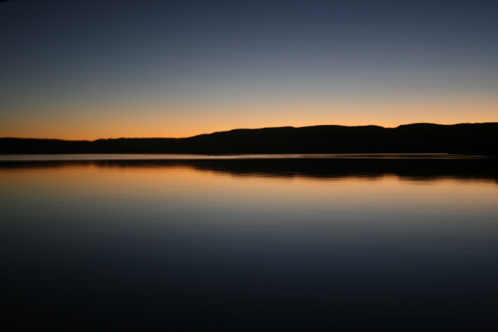
Sunset over Cambridge Gulf - Spectacular
 Wyndham is one of WA's oldest towns dating back over 130 years. There is a small port here which is used to bring in goods for the Ord River project and the east Kimberley region. Also used to export iron ore from a nearby mine. The trucks go 24 hrs a day - 7 days a week. Fishing is also big here and many of the tourists staying for long periods to take advantage of the conditions. Moving on from here down to El Questro, on to the Bungle Bungles then over through the Kimberleys to Broome


Wednesday, 1 June 2011

Katherine and Surrounds

41 Mile Bore Rest Area - Nice Fire

 Left Mt Isa and stayed at Camooweal to watch the State of Origin. Big mistake, thought we would win! Found another nice rest area near the Three Ways where there were about 6 more vans. Lucky we have our own loo as Diane objects to the bush variety. Watched the fire for an hour or so until our wood ran out. Camp fires are very popular at these places and wood is scarce.


Water Buffalo at Dunmara


Dunmara is a quite little place on the Stuart highway about mid way between Three Ways and Katherine. We had stayed there before so we knew what it was like - peaceful with adequate amenities. We were entertained by the water buffalo in a nearby paddock. The roadhouse shop sold buffalo steaks and hamburgers but we didn't try them!

 
Diane in the Mataranka Hot Springs


Mataranka is located about 112 km south of Katherine on the Stuart Highway. Its famous for the hot springs (about 34 deg) We stayed at the Binter Springs homestead where the warm water emanates from the Rainbow Spring, flows through the pools and eventually into the Roper River. An amazing 30 million litres per day flow through the pool! The area has a number of lyre birds (peacocks) which are very tame. They come right up to your van to be fed and would go inside if you let them.

The Beautiful and Serene Katherine River

Made the short trip to Katherine and booked into the Big 4 Low Level Resort. This is located in the Low level reserve on the Katherine River. Fishing is very popular here with barramundi often caught in the river. Today we rode along a nice cycle track from the park and into the town. On the way back we stopped at the Katherine Springs for a relaxing dip in the warm water. Katherine is most famous for the Gorge which we had visited previously. The town has all the necessities for the traveller and a good spot to stop for a few days. Had the car tyres checked and rotated here and stocked up on fuel and provisions.


Springvale Homestead

Visited the oldest farming homestead in the Territory at Springvale, just near our van park. The property was started in 1870 and originally 20,000 sq miles. It began with 12,000 sheep and 3000 cattle but the climate and environment weren't favourable and eventually it failed. It's now only one square mile and a tourist attraction with van park, restaurant and reserve.


Water Lillies in a Katherine River Billabong

The Springvale Reserve has a beautiful billabong which has many birds and animals including a small shy croc. Its a popular spot for tourists and locals to chill out.  There is an abundance of yabbies in the river and we saw quite a few nets set to catch them. One local said he often catches 40 to 50 and this is just about enough to feed his family. I think he liked to eat them!

Tuesday, 24 May 2011

Along the Landsborough Highway to Mt Isa

A B Paterson at the Winton Memorial


Winton is north-west from Longreach and another historical Queensland town. Banjo Paterson spent a lot of time here and wrote "Waltzing Matilda" on a property near the town. There is a Tattersalls Hotel here as well. I wonder how many Tatts Hotels there are in Australia? Stayed one night in the van park and had a quite beer and a bet in one of the four pubs.


Relaxing at Fountain Springs Rest Area
Decided to stay in a rest area called Fountain Springs which is mid way between Cloncurry and Mt Isa. A popular spot as the place was full. Had a nice camp fire which was difficult as there wasn't much firewood around. It was a most pleasant way to end a day's driving with a beer and stare at the fire.


MT Isa by Night
 Although located in the far west of Queensland, Mt Isa appears not to lack anything. All facilities, shopping and services are here. The climate is quite good with warm days and cool evenings. The pool at our park was inviting. Had a meal and a few drinks at the Overlander Hotel tonight. Reasonable prices and good food - even won $40.00 on the Pokies! Leaving tomorrow after we get the caravan bearings serviced and Diane gets her hair done. The picture above was taken from the lookout above the town. The smelter in the background dominates the city.