Powered By Blogger

Tuesday 30 August 2011

Cape Naturaliste and Ngilgi Cave

Drive Mechanism of the Cape Naturaliste Lighthouse
From Dunsborough we took an afternoon drive out to Cape Naturaliste and the Maritime Museum. We took the lighthouse tour and were fortunate to have an experienced guide with the three of us on the tour. Easier than most lighthouses to climb, the Cape Naturaliste Lighthouse is one of the most popular attractions in the Geographe Bay and Margaret River region.
View North from the Lighthhouse

Our tour guide provided a fascinating insight into the functions of the working lighthouse and the history of the area. He also told us how the lighthouse has changed with the times and the days when it was manned around the clock by 3 keepers on shift. It was a tough life in those days. The lighthouse began operation in 1904 and has been automated for the past 33 years. Except for the driving mechanism, it's still much the same as it was when it was built.
Light and Glass Lens


The light is now electric with a 120V 1000 W tungsten halogen globe -  the original light was fueled by kerosene. The lens is a Fresnel lens and is the original one fitted. These are no longer made so it would have to be replaced if it suffered damage. It's a relatively short lighthouse as it sits on a high headland. .
Cape Naturaliste Lighthouse


Wild White Lilies
The original light and turntable which still floats on a bath of mercury, was turned by a clockwork mechanism, which needed rewinding every 50 - 60 minutes at night. The light can be seen 46 Km away to sea. Prior to the building of the lighthouse, some 12 ships had become wrecked among the strong currents and dangerous reefs surrounding the sharp point. Located on a 100 metre cliff, the 19 metre high tower has also become a prime whale watching site.


We also took a trip to the Caves area  and visited the Ngilil Cave which is also near Dunsborough. The cave lies beneath the limestone ridge which forms Cape Naturaliste, at Yallingup. It was discovered in 1899, and formerly known as Yallingup Cave. It is one of Geographe Bay's most renowned tourist attractions.We took a guided tour of the cave and spent about an hour and a half down there. The temperature is a constant 20 degrees all year round so it's quite comfortable.  
Ngilgi Cave is associated with a rich Aboriginal legend describing a battle between a good and an evil spirit. This was described by our guide but we didn't really take much notice.
We did see the stunning stalactite, stalagmite, helicitite and shawl formations and took several photos of them. Some of the photos are shown below.


Ngilgi Cave

Ngilgi Cave

Ngilgi Cave

Ngilgi Cave

Ngilgi Cave

Ngilgi Cave

Ngilgi Cave
It was certainly fascinating walking through the cave and we enjoyed it very much. 
There are a few other caves in the area but not as impressive as Ngilgi Cave. If you had more time you might visit these as they are different from Ngilgi.
From Dunsborough, we drove the short distance of 70Km down to the township of Margaret River.

Bunbury and Busselton Area

Safety Bay (South of Fremantle)
We were looking forward to the south west of the state as the travel distances between towns and places of interest being much shorter than the north. Also, the scenery down here is much different to the north and west, a bit like that in parts of NSW and Victoria.

Safety Bay and Carpark
There were several nice spots on the coast on the way down from Perth. We were able to call into many of these to see the fantastic views and scenery. We stopped 2 nights in Bunbury on Koombana Bay. Bunbury is a large city of about 51,00 people in the area. I think it's the 2nd largest outside Perth. They cater pretty well for tourists in all these towns and there are many walks including one along the waterfront near our park.
Koombana Bay Bunbury from Marlston Lookout

Unfortunately the weather wasn't the best when we were in Bunbury so we couldn't appreciate the place at its best. You can get a good view of the city and coastline from Marlston Hill lookout in the middle of the city. As in most places on WA's coast, there are lots of boats in their harbours. The Western Australians must be a rich lot!

Diane and Peter on Windy Busselton Jetty

From Bunbury we drove down to Busselton, which is only 60Km away. We didn't stay long in Busselton as the weather still wasn't the best. We did, however, go out on the famous Busselton Jetty which is probably the most well known attraction here. At 1.8Km long, the jetty is the longest timber jetty in the southern hemisphere. It was built 145 years ago to enable goods to be shipped into and out of this region. They have an underwater observatory at the end of the pier and a small train ride out to the end. Due to the poor weather both of these were closed.
Busselton Jetty and Heritage Buildings

A lot of the town's activities are on and around the waterfront which would be a great place to be in good weather. There are also many good restaurants here and are visited by local, tourists and many people from Perth due to its location.

1.8 Km Long Busselton Jetty
We were told that there are 30Km of white beaches with crystal clear water around Busselton but it wasn't like that for us. We had to take their word for it as the water was pretty rough when  were there.


Busselton Jetty Shorebreak
Busselton is a resort town and also the gateway to the Geographe Bay area, Cape Naturaliste and the Margaret River region. There's enough here to spend several weeks visiting but we only had a couple of weeks. Busselton also has possibly the best caravan park in Australia. We didn't stay there but the people we spoke to who did raved about it. It's called the Mandalay Tourist Resort.


Surfing at Yallingup (near Dunsborough)
From Busselton we drove another 30 Km to Dunsborough, and stayed another 2 days there. The wet weather was still with us but still managed to get a few glimpses of sun and made the most of them. Although the weather didn't stop the surfers, we didn't venture into the water. I think we'll have to wait till summer now.

Sunday 28 August 2011

Rottnest Island

Rottnest Coastline at Thomson Bay
We decided to take our bikes over to Rottnest and ride around the island. As our caravan park was relatively close to the ferry terminal, we rode the 4 Km from the park along the waterfront. This was an experience to see the old heritage buildings alongside the modern and all the boating facilities.
Cycling Around Rottnest

The Rottnest Express ferry trip takes about 25 minutes to travel the 19Km from Fremantle and costs $65.00 return for seniors. This also includes the "landing fee". Seemed a bit expensive to me but there's no other way of getting there. The ferries are very modern with TVs, food outlet, and comfortable seating. They run a few times in the morning and a few return trips later in the afternoon. No cars are allowed on the island so the only ways to get around are walk, cycle or bus. The normal thing is to hire bikes (they literally have hunderds for hire) or catch the hop on hop off bus. We were definitley in the minority with our own bikes.


Peter & Diane at Salmon Bay - Rottnest
The distance around the island's circuit road is about 24Km. Around the island there are 63 beaches and 20 bays, all with pristine waters and great scenery. We set off from the main area at Thomson Bay and intending to take about 4 hours to do the lap.


Porpoise Bay at Rottnest

Even though it was a coolish weekday, there were several other people doing the same as us. Cycling around the island is definitely the best way to go as you can make your own pace. The bus operates on a good schedule and you can get off at various locations, see the area, and get on the next one. There are several walking tracks off the main road enabling you to easily get to the beaches.
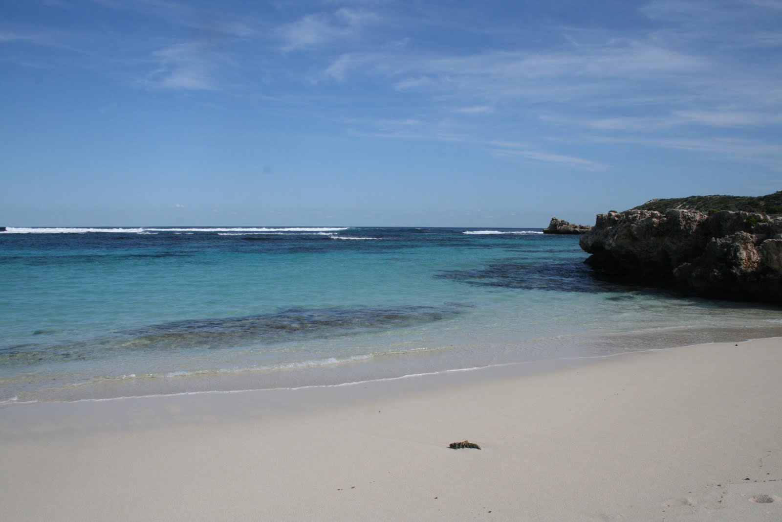
The Beautiful Waters of Porpoise Bay


View from Wadjemup Lighthouse
The water supply on the island is a combination of harvested rainwater, underground supplies and a desalinated groundwater system using the reverse osmosis process. Their electricity comes from wind turbines and a diesel generator system.The wind turbines deliver 37% of the island's requirements.
In 1996 Rottnest introduced the first public place recycling program in Western Australia. In 2000 the island won the 3R awards (reduce, reuse and recycle). A daily supply barge - Spinifex - makes a return trip from Fremantle, delivering supplies and removing rubbish.

Rottnest's Beautiful Geordie Bay

Rottnest Island was inhabited by Aboriginal people from about 30,000 years ago, until rising sea levels separated the island from the mainland of Western Australia approximately 7,000 years ago. The island was observed by the Dutch from 1610 with the first landing in 1658 The island was given the name "Rattenest" (meaning "rat's nest" in  Dutch) by the Dutch fleet captain Willem de Vlamingh on 29 December 1696. De Vlamingh described the indigenous marsupial, called a quokka, as a large rat.
Government House Lake on Rotnest

The eastern end of the island near the lighthouse, has some freshwater lakes. The colours are fascinating. One of them is a pink lake, the one next to it is bright blue. For whatever reason only one of the lakes contains  bacteria that create the pink colour.The lakes are populated by many different species of water birds and plants.

Lighthouse Keepers House from Bathurst Lighthouse

Rottnest was the site of an internment camp in both World War I and II. In WWI it was mostly used for German and Austrian suspected enemy aliens, before being closed towards the end of the war due to poor conditions. Also during World War II, two 9.2-inch guns were installed near the middle of the island at Oliver Hill, for defence of the Fremantle port. Two 6-inch guns were also installed at Bickley Point. The location of the island was seen as being crucial to the defence of the important port of Fremantle, the major base for the Allies in the Indian Ocean, as bombardment of any attacking ships could be made from the island before the ships would come into range of the port.

One of Rottnest's Delightful Quokkas

The quokkas are unique to Rottnest and not found on the mainland or anywhere else in the world.
We saw this quokka in the main tourist area of the island, apparently quite tame as it easily took food from us by hand. The quokkas are quite animals and have survived due to the absence of feral cats and foxes which would soon wipe them out.

Geordie Bay Looking East

The island became largely devoted to recreational use from the 1900s, aside from a brief period of exclusive military use during World War II. It is now visited by nearly 500,000 a visitors a year, an average of 330,000 of those arriving by ferry or air taxi per. 70% of all visitors come for the day only. The majority of visitors come in summer, with nearly 20% of all visitors coming in January. The island has accommodation for up to 2,850 visitors, while day-only visitors can number up to 5,000 at any one time. There are no private ownership on the island with the Rottnest Island Authority administering everything. Demand for accommodation is very high during the summer months, with ballots held annually for accommodation during the January and Easter school holiday periods.

Geordie Bay Looking West
The coastline of Rottnest is a remote and wonderful place which can best be enjoyed by getting around the island at your own pace. The roads are  mostly flat but a few hills sorted Diane out, especially at the end when she was just about worn out. We can certainly recommend a trip out to Rottnest for visitors to Perth and do it on a bicycle.
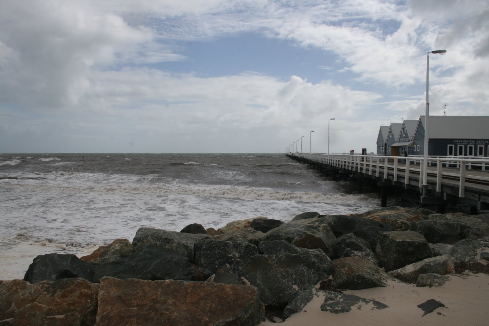
The next day we took off along the Perth to Bunbury Highway for a few weeks in the South - West of the state.